Here is the fifth clip from The Great Urban Debate between Peter Steinbrueck (Seattle) and Gordon Price (Vancouver).
Who's got it right? Vancouver with their "pencil towers" that have civic spaces at the base? or Seattle with their planned neighborhoods.
Conviviality
by Richard Borbridge, VIA's Vancouver Urban Planner
While the debate continues about future of public civic space in Vancouver, we have a perfect opportunity to think about one important role and reason for public space – fostering conviviality. Lisa Peattie, Urban Studies professor at MIT, defines conviviality as the quality of lively socialness, expanding on the social learning theories of Ivan Illich that see conviviality as “autonomous and creative intercourse among persons, and the intercourse of persons with their environment.” In a planning context, convivial cities are those that provide opportunities for casual social connection between people in the city — communication and collocation — whether though complementary urban design or market-driven development of third places.
 Conviviality is tightly connected to Ray Oldenburg’s concept of “third places”, those besides home and work, which lend space to convivial interaction through cafés, pubs, diners, and hangouts – places that are active in promoting a sense of community and shared experiences between friends and familiar strangers. Vancouver at a glance is not short on third places, but the recent struggles to find art and performance space in our “creative city” highlights the narrow definition downtown Vancouver has fostered.
Public open spaces have a critical role to play in our civic and social infrastructure, which has been predicated on the existence of free spaces and an unencumbered right to free association and expression. Think of convivial spaces as our Olympic free speech zones – only less ironic. Conviviality may even inspire anti-establishment movements or new demands on governments. Planners are especially susceptible to critique in these situations, by recommending and defending their existence and convivial spaces, but they are also responsible to the governments that these movements may defy.
Since conviviality as a concept carries the advantage of existing outside economic frameworks – being exclusively non-material – it cannot be “coerced or bought, but the resources used in the production of conviviality—space, seats, food and drink… may be sold or rented or ceded by owners and governments.” This has tended to typify Vancouver’s response to public spaces, concentrating on development projects and streetscapes while never quite achieving that one landmark civic site.
 Robson and Granville streets often sited as the great aggregators of people downtown, but as the domain of businesses and disruptively, of traffic, they are only embraced when the collective energy can’t be contained after a hockey game or Presidential election. They are inadequate for a gathering function and too often manic conduits that people are more apt to shut out with a phone call or ibuds. These should serve as great streets for watching the ebb and flow of humanity but we’ll have to see how the new street furniture pans out before sealing their fates. Inclusively we have the Art Gallery – both sides of it – one for “alternative” crowds, though no larger than a couple hundred, the other for issues, stalking you from Sears to Café Row.
Vancouver is in the middle of the debate and obviously hungry for a fresh and functional civic space, a place separate from – or at least not focussed on – cars and commerce is key. So whether at the centre or the edge, it is most vital that we soon find a place to find our voice since, as Peattie believes, “in human happiness, creative activity and a sense of community count for at least as much and maybe more than material standard of living.”
So find a third place and try on a little conviviality this weekend…you wouldn’t want Vancouver to be the next target for a Coors Light ad would you?

For photo credits, see above links
While the debate continues about future of public civic space in Vancouver, we have a perfect opportunity to think about one important role and reason for public space – fostering conviviality. Lisa Peattie, Urban Studies professor at MIT, defines conviviality as the quality of lively socialness, expanding on the social learning theories of Ivan Illich that see conviviality as “autonomous and creative intercourse among persons, and the intercourse of persons with their environment.” In a planning context, convivial cities are those that provide opportunities for casual social connection between people in the city — communication and collocation — whether though complementary urban design or market-driven development of third places.
 Conviviality is tightly connected to Ray Oldenburg’s concept of “third places”, those besides home and work, which lend space to convivial interaction through cafés, pubs, diners, and hangouts – places that are active in promoting a sense of community and shared experiences between friends and familiar strangers. Vancouver at a glance is not short on third places, but the recent struggles to find art and performance space in our “creative city” highlights the narrow definition downtown Vancouver has fostered.
 Public open spaces have a critical role to play in our civic and social infrastructure, which has been predicated on the existence of free spaces and an unencumbered right to free association and expression. Think of convivial spaces as our Olympic free speech zones – only less ironic. Conviviality may even inspire anti-establishment movements or new demands on governments. Planners are especially susceptible to critique in these situations, by recommending and defending their existence and convivial spaces, but they are also responsible to the governments that these movements may defy.
Since conviviality as a concept carries the advantage of existing outside economic frameworks – being exclusively non-material – it cannot be “coerced or bought, but the resources used in the production of conviviality—space, seats, food and drink… may be sold or rented or ceded by owners and governments.” This has tended to typify Vancouver’s response to public spaces, concentrating on development projects and streetscapes while never quite achieving that one landmark civic site.
 Robson and Granville streets often sited as the great aggregators of people downtown, but as the domain of businesses and disruptively, of traffic, they are only embraced when the collective energy can’t be contained after a hockey game or Presidential election. They are inadequate for a gathering function and too often manic conduits that people are more apt to shut out with a phone call or ibuds. These should serve as great streets for watching the ebb and flow of humanity but we’ll have to see how the new street furniture pans out before sealing their fates. Inclusively we have the Art Gallery – both sides of it – one for “alternative” crowds, though no larger than a couple hundred, the other for issues, stalking you from Sears to Café Row.
 Vancouver is in the middle of the debate and obviously hungry for a fresh and functional civic space, a place separate from – or at least not focussed on – cars and commerce is key. So whether at the centre or the edge, it is most vital that we soon find a place to find our voice since, as Peattie believes, “in human happiness, creative activity and a sense of community count for at least as much and maybe more than material standard of living.”
So find a third place and try on a little conviviality this weekend…you wouldn’t want Vancouver to be the next target for a Coors Light ad would you?

For photo credits, see above links
Uptown, meet your old neighbor, South Lake Union
by Matt Roewe, VIA's Director of Mixed-use and Major Projects
In the heart of Seattle, two vibrant neighborhoods will soon be re-joined after 60 years of separation by the “Great Wall of Aurora.” The stars have aligned on three major projects to produce an outcome that will re-knit the street grids across aurora and rekindle the livable and walkable association between these old friends.
The Mercer Street project will start this off by reorganizing the “Mercer mess” through South Lake Union (SLU). Making this corridor a simple, two way and straight “Champs Elyse” tree lined boulevard connecting Interstate 5 to the Seattle Center and on to Elliott Avenue near Puget Sound. This enables better urban design, pedestrian safety and a straightforward travel pattern for the frequent unfamiliar visitors to the area. It also yields a calmer Valley Street next to SLU Park and a new two-way Roy Street in Uptown. Property owners are giving up 50’ to allow the wider boulevard, which is timely for the plethora of new development proposals for this under utilized area. The highway like diagonal Broad Street goes away, allowing the orthogonal street grid to return.
I participated in a 40 person/organization stakeholder charrette over the last two years where consensus was reached by all participants including freight, bicycle, business, institutions and neighborhood groups. Construction is scheduled to start in the next year, although the SR99 North portal project described below may impact the timing. See more project info at: Mercer Corridor

The Bill and Melinda Gates Foundation new headquarters is well underway at 5th and Mercer. With 2000 jobs and a 1,300,000 SF masterplan on 12 acres, this project is a huge community asset, as well as, a real game changer for neighborhood planning. Some would like to rename Mercer Street as “The Road to Global Health” with this institution as the anchor destination.
The Gates foundation is currently a lynch pin in the negotiations with two way Mercer and the SR 99 North Portal as the reconnection of 6th Avenue through or around this campus is critical to the success of the circulation and street grid system. An Illustration below reveals a potential mutually beneficial outcome for both the foundation and the neighborhood. For more info go to: New Campus FAQ

Alaskan Way Viaduct (SR99) Bored Tunnel: North Portal is currently designed to pull together the two neighborhoods by “lidding” SR99 from Republican Street to Denny way, effectively creating new streets and blocks at grade at Thomas, John, & Harrison. This will effectively make SR 99 go away and allow this burgeoning area to be reconnected allowing an entire network of choices available to bikes peds, trucks and automobiles.
The urban design consequences of the North Portal are phenomenal. The city is currently working closely with stakeholders in the area to develop a framework urban design plan that capitalizes on this new potential. An entirely new set of street typologies is possible to create new development potential and greatly enhance the existing fine grain fabric.
The “lost triangle” district, also know as the Denny/Broad/Aurora Triangle, is wedged between Aurora and Seattle Center. The new connections to this area via the north portal project will give this neglected and underutilized area a reason to be a vibrant and complete community offering residential and commercial development potential, all within walking distance of Downtown and all things Uptown/SLU.
There is also a movement to develop an east/west streetcar system extension from the upcoming first avenue green line terminus at Key arena to the Cascade Neighborhood. Thomas and Harrison are likely to be couplet streets and August Wilson Way in Seattle Center is the likely route for this streetcar. Look forward to future posts on this fun topic.
Also in the works is the City proposed EIS alternatives for SLU increasing the height and density of the area significantly with potential trade offs for public benefits. This is an aggressive move to best utilize this area to meet the targeted growth of 20,000 jobs and 10,000 housing units (includes the DBA triangle and SLU area). I can’t think of any neighborhood in the entire northwest taking this kind of responsibility for sustainable, less car dependent growth. Hence, the investment of these projects is rewarding the place taking on the burden of growth in a manner that no other area regionally can achieve.

 Politics and regime change: With the imminent appointment of a new mayor and two city council members, these issues will likely get further attention. The two-way Mercer project first phase is already approved and the current Mayor, the Governor and the state legislature have approved the SR99 Bored Tunnel Project. However, the design of the tunnel is still very young and funding is not 100% certain, so these may get revisited. The bottom line for Uptown/SLU is connectivity. Even without the north portal lid, the street grids could still be reconnected via stop lights on Aurora. Not the most desirable condition, but we can still proceed with planning on a better network of connections and relationships.
These are exiting times with many challenges, hurdles, political debate and further exploration. Let us dig in and continue the journey.
In the heart of Seattle, two vibrant neighborhoods will soon be re-joined after 60 years of separation by the “Great Wall of Aurora.” The stars have aligned on three major projects to produce an outcome that will re-knit the street grids across aurora and rekindle the livable and walkable association between these old friends.
The Mercer Street project will start this off by reorganizing the “Mercer mess” through South Lake Union (SLU). Making this corridor a simple, two way and straight “Champs Elyse” tree lined boulevard connecting Interstate 5 to the Seattle Center and on to Elliott Avenue near Puget Sound. This enables better urban design, pedestrian safety and a straightforward travel pattern for the frequent unfamiliar visitors to the area. It also yields a calmer Valley Street next to SLU Park and a new two-way Roy Street in Uptown. Property owners are giving up 50’ to allow the wider boulevard, which is timely for the plethora of new development proposals for this under utilized area. The highway like diagonal Broad Street goes away, allowing the orthogonal street grid to return.
I participated in a 40 person/organization stakeholder charrette over the last two years where consensus was reached by all participants including freight, bicycle, business, institutions and neighborhood groups. Construction is scheduled to start in the next year, although the SR99 North portal project described below may impact the timing. See more project info at: Mercer Corridor

The Bill and Melinda Gates Foundation new headquarters is well underway at 5th and Mercer. With 2000 jobs and a 1,300,000 SF masterplan on 12 acres, this project is a huge community asset, as well as, a real game changer for neighborhood planning. Some would like to rename Mercer Street as “The Road to Global Health” with this institution as the anchor destination.
The Gates foundation is currently a lynch pin in the negotiations with two way Mercer and the SR 99 North Portal as the reconnection of 6th Avenue through or around this campus is critical to the success of the circulation and street grid system. An Illustration below reveals a potential mutually beneficial outcome for both the foundation and the neighborhood. For more info go to: New Campus FAQ

Alaskan Way Viaduct (SR99) Bored Tunnel: North Portal is currently designed to pull together the two neighborhoods by “lidding” SR99 from Republican Street to Denny way, effectively creating new streets and blocks at grade at Thomas, John, & Harrison. This will effectively make SR 99 go away and allow this burgeoning area to be reconnected allowing an entire network of choices available to bikes peds, trucks and automobiles.
The urban design consequences of the North Portal are phenomenal. The city is currently working closely with stakeholders in the area to develop a framework urban design plan that capitalizes on this new potential. An entirely new set of street typologies is possible to create new development potential and greatly enhance the existing fine grain fabric.
The “lost triangle” district, also know as the Denny/Broad/Aurora Triangle, is wedged between Aurora and Seattle Center. The new connections to this area via the north portal project will give this neglected and underutilized area a reason to be a vibrant and complete community offering residential and commercial development potential, all within walking distance of Downtown and all things Uptown/SLU.
There is also a movement to develop an east/west streetcar system extension from the upcoming first avenue green line terminus at Key arena to the Cascade Neighborhood. Thomas and Harrison are likely to be couplet streets and August Wilson Way in Seattle Center is the likely route for this streetcar. Look forward to future posts on this fun topic.
Also in the works is the City proposed EIS alternatives for SLU increasing the height and density of the area significantly with potential trade offs for public benefits. This is an aggressive move to best utilize this area to meet the targeted growth of 20,000 jobs and 10,000 housing units (includes the DBA triangle and SLU area). I can’t think of any neighborhood in the entire northwest taking this kind of responsibility for sustainable, less car dependent growth. Hence, the investment of these projects is rewarding the place taking on the burden of growth in a manner that no other area regionally can achieve.

 Politics and regime change: With the imminent appointment of a new mayor and two city council members, these issues will likely get further attention. The two-way Mercer project first phase is already approved and the current Mayor, the Governor and the state legislature have approved the SR99 Bored Tunnel Project. However, the design of the tunnel is still very young and funding is not 100% certain, so these may get revisited. The bottom line for Uptown/SLU is connectivity. Even without the north portal lid, the street grids could still be reconnected via stop lights on Aurora. Not the most desirable condition, but we can still proceed with planning on a better network of connections and relationships.
 These are exiting times with many challenges, hurdles, political debate and further exploration. Let us dig in and continue the journey.
Seattle vs. Vancouver: Who has better civic spaces?
Here is the fourth clip from The Great Urban Debate, in which Gordon Price and Peter Steinbrueck debate Seattle and Vancouver's civic spaces.
Watch this short 2 min clip and let us know your thoughts. Does Vancouver need to work on their civic spaces? Seattle has Westlake and Seattle Center, but do they maximize their potential?
Watch this short 2 min clip and let us know your thoughts. Does Vancouver need to work on their civic spaces? Seattle has Westlake and Seattle Center, but do they maximize their potential?
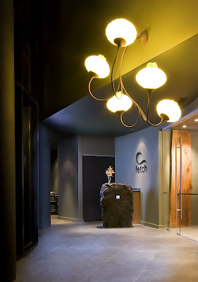
Blackrock Resort: Urban escape route with edgy appeal
Click here to read a recent article from the Vancouver Sun, which featured the new Oceanfront Resort, as a "dramatic medley of rock, water, glass, steel and wood."


For the resort website, click here.
Photo credits: Black Rock Resort and Chris Pouget from Coast Image


For the resort website, click here.
Photo credits: Black Rock Resort and Chris Pouget from Coast Image
Opening of Canada Line - First Impressions
by Gordon Price, Director of City Program at Simon Fraser University [Pricetags blog]
My first impression? Crowds.

I gave up trying to start at Waterfront Station, and took a trolley to Yaletown. Crowded too, but pleasant:

Yaletown Station is a bit better than City Centre, but still has that affable blandness.

I confess, I like d the little folly that used to occupy this space in Curtis Plaza. Its only function was to house the elevator for the parking garage below, but it fit. Nonetheless, Yaletown Station may add a little life to this space if properly programmed.
It’s a three-minute ride to City Hall. Finally, Vancouver’s civic centre will be more practically connected to its central business district. [Side note: the Hall is where it is because of the civic politics of the 1930s, just after three municipalities amalgamated to create the Vancouver we know today. It wouldn't do to have the new City Hall located downtown (they even rejected an offer to buy the bankrupt Marine Building), and so it was built in what was then a Mt. Pleasant park.]
Anyway … I didn’t get off. Decided to take the train to Bridgeport, where the action will be when TransLink funnels most of the southern buses into this station. That meant 20 minutes in a tunnel.
As the train emerged into the light, there was an audible gasp of relief. Vancouverites have gotten used to a SkyTrain perspective, and don’t take well to riding underground. Still, it’s now possible to traverse the width of the city in the time it takes to flip through a newspaper, and to do it standing up. The ride is smooth, quiet and stable.
Beyond Marine Drive, a chance to fill in some of the holes in my mental map, to get a sense of the industrial lands that are already being eyed for transformation.

As near as I could see, a lot of this land is filled with cars – not my definition of ‘industrial’. And not likely to stay that way.
Same on the Richmond side:

Richmond has been aggressive in planning for more urbanity around its stations. Bridgeport, in addition to being the only park-and-ride in the system, is anticipated to be a playground for the kind of adult activities already provided by the River Rock Casino. The hotel-casino complex is nice enough (they even have their own wetland!), but they clearly skimped on the connection between the hotel and the station:

The landscape around Bridgeport is a suburban wasteland:

But all that’s going to change. Bridgeport is one of those places where, after a few years, you forget what used to be there, not that any of it was memorable in the first place.
No time to check out No. 3 Road (a place already evidence of the previous statement), so back on the train (after an hour wait) to City Hall Station.
This one is the best of the lot in Vancouver:

The wood, the curve, the tilt and the grade all work together to create a dynamic experience, visually and on foot, since the elevation of the platform is close to the grade of Broadway. When new buildings to the east frame the station, it will all look even better. And when the northeast corner of Cambie and Broadway has development equal to what has already occurred to the north, this will be an intersection worthy of the view.

Back on the train, no wait, to finish the trip at Waterfront – our great nexus of transportation modes (can anyone name a place that has a better mix?) – at the place, in 1887, where Vancouver literally got its start.

Not this place, of course (it’s the second CPR station) – but what a statement! As they said of Pennslyvania Station in New York (before they tore it down), one enters the city as a king. It may be that the Canada Line doesn’t connect seamlessly with the Expo Line – but if it means transferring by way of this great room, it’s more than worth the trouble.
The Canada Line is truly something to celebrate: only rarely does a city get to open such an elemental piece of infrastructure. We will be shaping our region around it for the next century. No, it’s not everything it should be (more art, please) and, yes, the station platforms should have been built for the next century too. But it’s a fine addition to a city that has a very high bar when it comes to public transportation.
Oh, one more thing – the arty shot. The tunnel is lit, and in some places is surprisingly steep and curvy. When you’re up in the front, looking through the big picture window - well, it’s the kind of experience that kids never forget.

Rethinking Highest and Best Use
by Catherine Calvert, VIA's Director of Practice + Director of Community Architecture
 I recently had the opportunity to visit upstate New York and to learn about cycles of urban decline not only associated with our current economic downturn, but that are the result of decades of post-industrialization. The conference I attended, organized by the Association for Community Design, included presentations by representatives from Buffalo, Pittsburgh, Philadelphia, Troy, Flint, Rochester and others – all cities that are trying to figure out what to do with a surplus of vacant urban land at a time when hope is scarce.
Here in Cascadia, our cities look very different. Not only are we relatively younger, but even in the most economically challenged areas, land values remain high and neighborhoods are for the most part occupied. Not so in these eastern and midwestern cities, where a downward spiral of job loss, population decline, property abandonment, repossession and eventual demolition of individual buildings erodes at the integrity of once-intact neighborhood fabric. Cities find themselves as owners of a sizeable land bank of empty lots, owners adjacent to vacant land watch as their own property values decline, and inner cities become less and less viable places to live.
Associated with the decay of neighborhoods comes a lack of choices about food supply. Many public markets once prominent in most major urban centers have been lost to private enterprise over time. When neighborhoods are no longer considered to provide adequate catchment area for a grocery store, they are left with only corner stores and convenience markets as their primary food source. This results in “food deserts” that have serious public health and social justice implications.
 Urban agriculture is a hot topic at the moment. Farmers markets and the demand for local food are exploding across America. Many cities actively support the creation of P-patches so that residents without access to land are able to grow their own vegetables. Gardening matchmaker websites offer to pair land-challenged urban gardeners with underutilized-yard-owners. But personal food production is not the only reason to utilize vacant land for non-traditional uses. To paraphrase Matt Potteiger from SUNY, conventional landscape architectural practice remains focused on food supply for species other than our own. We are clearly at the tip of the iceberg in terms of utilizing the full potential of the urban spaces between buildings. What if “highest and best use” referred not to development potential, but to social and ecological potential?
As designers and activists we can have a positive effect on the physical relationships between land uses, access to food supply, and the design of our communities to restore ecological function. Some fascinating initiatives are taking place in other cities. What these all share is a reframing of the problem; turning decline into an opportunity to put back what may be missing, but at the same time busting out of conventional notions of what is viable urban space:
 I recently had the opportunity to visit upstate New York and to learn about cycles of urban decline not only associated with our current economic downturn, but that are the result of decades of post-industrialization. The conference I attended, organized by the Association for Community Design, included presentations by representatives from Buffalo, Pittsburgh, Philadelphia, Troy, Flint, Rochester and others – all cities that are trying to figure out what to do with a surplus of vacant urban land at a time when hope is scarce.
Here in Cascadia, our cities look very different. Not only are we relatively younger, but even in the most economically challenged areas, land values remain high and neighborhoods are for the most part occupied. Not so in these eastern and midwestern cities, where a downward spiral of job loss, population decline, property abandonment, repossession and eventual demolition of individual buildings erodes at the integrity of once-intact neighborhood fabric.
 Cities find themselves as owners of a sizeable land bank of empty lots, owners adjacent to vacant land watch as their own property values decline, and inner cities become less and less viable places to live.
 Associated with the decay of neighborhoods comes a lack of choices about food supply. Many public markets once prominent in most major urban centers have been lost to private enterprise over time. When neighborhoods are no longer considered to provide adequate catchment area for a grocery store, they are left with only corner stores and convenience markets as their primary food source. This results in “food deserts” that have serious public health and social justice implications.
 Urban agriculture is a hot topic at the moment. Farmers markets and the demand for local food are exploding across America. Many cities actively support the creation of P-patches so that residents without access to land are able to grow their own vegetables. Gardening matchmaker websites offer to pair land-challenged urban gardeners with underutilized-yard-owners. But personal food production is not the only reason to utilize vacant land for non-traditional uses. To paraphrase Matt Potteiger from SUNY, conventional landscape architectural practice remains focused on food supply for species other than our own. We are clearly at the tip of the iceberg in terms of utilizing the full potential of the urban spaces between buildings. What if “highest and best use” referred not to development potential, but to social and ecological potential?
As designers and activists we can have a positive effect on the physical relationships between land uses, access to food supply, and the design of our communities to restore ecological function. Some fascinating initiatives are taking place in other cities. What these all share is a reframing of the problem; turning decline into an opportunity to put back what may be missing, but at the same time busting out of conventional notions of what is viable urban space:
- In Buffalo, a program called the Massachusetts Avenue Project runs an urban agriculture and aquaponics program for youth that focuses on farming education, business training in food marketing and peer communication on healthful eating habits. The resulting health and educational benefits support the entire community.
- Joan Iverson Nassauer’s study of Genesee County, MI looks at their urban land bank as an opportunity to restore much of the ecological function that was lost during original urbanization. The resulting community resource actually improves land values and prepares the city for its next stages of evolution and urban vitality.
- In Pittsburgh, a group of students is using empty lots to grow plant materials for biofuels.
- In Philadelphia, the Community Design Collaborative is looking at developing smaller urban infill outlets for local produce that are more permanent than farmers markets.
APTA review
by Kate Howe, VIA's Urban Planner
 I am just back from attending the APTA sustainability conference in Utah’s Salt Lake City. The sessions focus on tackling climate change – increasing transit accessibility to the pedestrian, land use integration and green design. This is the fifth in the sustainability workshop series, and reflects how transit agencies have moved forward to implementation of sustainability strategies – from Ben Franklin Transit’s ethanol/biodiesel fuel mix in Louisville, to the 25 iphone apps created by creative types for Portland Tri-met that help to blend transit use into the everyday life.
I thought that the star session was the first session, a panel discussion with the new Deputy Administrators appointed by the Obama Administration – three articulate progressives from the EPA - HUD- DOT that travel together to talk about how to create new efficiencies between the three agencies and link transportation funding to land use and environmental policy. Unimaginable only a year ago – these three have their work cut out for them.
Jim Lopez – a former Seattlite who went to Washington with Ron Sims, is now heading up HUD’s Sustainable Communities office. This office is beginning to pay attention and understands that to win the smart growth battle- many communities would benefit from Federal technical assistance to conduct long range planning. Lopez in particular discussed the need for a large scale audit of land use policies in order to make legal the mixed-urban environments that are the hallmark of low VMT, low energy use communities. DOT noted that new funding sources will be shifted towards move competitive grants, to reward transit agencies and municipalities that work together, and will attempt to move away from the dedicated funding streams that may allow inferior quality work – or projects that really don’t benefit the long term.
 This discussion segued nicely into a talk by the Brooking’s Institute Christopher Leinberger – who from his perspective as reformist real estate mogul, discussed the market pendulum swinging back from a concentration on single family suburban to mixed-use and urban – simply because this housing type remains significantly under built. He writes that “the most compelling evidence is the price premium people are willing to pay to live in a walkable urban place, that the survey's show anywhere from a 40% to 200% price premium on a price per square foot basis for a walkable urban place as oppose to a competitive near by drivable suburban place.”
He also highlights the demographics: in twenty years the shrinking household size we are already seeing will only become more pronounced; only 14% of households will have children with 80% being singles and couples. To accommodate a complexity of household types, as well as rising costs in infrastructure he talked about how we need to move the real estate industry from the NASCAR model -- quick (and often low quality) green field projects to the Jet Plane – by necessity more complex transactions in urban areas.
The second day included a session on the new FTA sponsored research report “Moving Cooler” that itemizes strategies on how public transport and related transportation systems can be shifted to aggressively respond to climate with GHG emissions reductions. This is an important project for APTA and all public transit advocates – because it helps to get the word out- particularly to fill in the information gap now operating in Congress about transit and its impact on climate mitigation.
Data is lining up in favor of compact development, and increased investment in transit to reduce GHG emissions (and all kinds of other ills). Unfortunately the "business as usual" approach endures, exemplified by the AASHTO lobbyist who stood at the podium making the (misguided) claim to an audience of public transit operators and sustainability advocates that you "can build your way out of congestion" -- like we do in UTAH! He also said that they stop at nothing to ensure an uncongested freeway. Wow --they must be really nervous about the new Federal Reauthorization Bill!
In Town, Without My Car!
by David Hiller, Advocacy Director Cascade Bicycle Club
 Across Europe, the 22nd of September is a day when town centers close to cars and trucks, and open up for people to enjoy walking, cycling, live music, dancing, public art and children's play areas. The event, called In Town, Without My Car!, represents a turning point in how we view the public space normally devoted to the movement and storage of private motor vehicles.
In Town, Without My Car!, Ciclovia’s and events like them allow us to question what our streets are really for, and whether we’re striking the right balance between the differing and often competing needs of street users. Should these public spaces be designed to maximize throughput of motor traffic, or should the emphasis be on creating places where people can engage in life’s activities in relative peace and quiet and safety? However brief, street closures give us a tantalizing glimpse of what our downtowns could be like with fewer cars and more people.
In Town, Without My Car! is a campaign that shares the streets-for-people philosophy of the London Mayor's Transport Strategy - using the streets as social spaces and for public transport, walking and bicycling. It is about improving the quality of life, allowing people to come together and see how much better life can be when cars are simply withdrawn from the urban mix. The campaign’s objective is simple, to give priority to people over traffic.
Too often, town centers have been sacrificed to busy roads: the New Deal for Transport will give priority to people over traffic... We want towns and cities to be places where people want to live. The New Deal for transport will support the urban renaissance that is essential to revitalize urban living... this means people being able to go about their daily business without being intimidated by traffic... Traffic can be calmed from the outset by designing for low speeds. Sometimes new developments can be designed to be 'car free'. (Source: A New Deal for Transport - Better For Everyone, DETR, July 1998 (all from UK Dept for Transport))
 Our local version, Celebrate Seattle Summer Streets, is only in its second year, but has become a part of the fabric of the city. While fourteen events between April and September are hardly a revolution, they are a first important step toward reclaiming these valuable public spaces. Celebrate Seattle Summer Streets opens up streets to pedestrians and bicyclists, offering people a way to have fun, celebrate the spirit and personality of their neighborhood, and support local businesses. Alki Beach was a blast with thousands of visitors, and this coming weekend, on Saturday, August 8, Rainier Avenue – a busy arterial in the south end of town – will be closed in Columbia City.
The message is simple; Streets are the souls of our neighborhoods and the pathways to the region’s destinations. They are more than just car corridors; they are valuable civic spaces, resources, which must be wisely allocated.
 This approach is far from new. In the early 1970’s Copenhagen inverted its planning pyramid – putting people first, followed in 1982 by Amsterdam’s policy officially giving priority to the bicycle. Similarly, in 1996 Vancouver, B.C. chose to prioritize walking, biking, transit and goods movement, while limiting single-occupancy vehicle accommodation. Ten years after implementing that policy, miles driven in Vancouver has decreased 29% - though the number of all trips increased 23%. At the same time, there was almost no increase in congestion.
This practice of putting people and places ahead of cars is called “mode priority.” Mode priority is the basic concept behind a wide range of transportation and planning reforms. It changes how we allocate road space, fund projects and commit resources. Moreover, it is the guiding doctrine that transformed car-choked cities in Europe into world leaders in mobility and livability.
Locally, Washington State’s Growth Management Act requires that cities adopt and regularly update Comprehensive Plans of Development. Under the Act cities must also identify a suitable Level of Service for public infrastructure, which must be met within a fixed period following new development. For too many communities it is convenient to default to an arbitrary Level of Service (LOS) based on vehicle delay. The infrastructure needed to meet that standard in many cases undermines or actually prevents travelling by foot or bicycle. There are alternatives, while I don’t have the room to go into them here, Multi-Modal LOS’s are rare or new, or even complicated.
Inverting the planning hierarchy or mode priority would make safe, convenient, and comfortable travel by foot the paramount priority. For our part, the Cascade Bicycle Club is working to pass legislation that will make this the official planning paradigm of the City of Seattle.
Our cities and towns need to invest billions to accommodate the 25% of trips that are less than one-mile, and the 40% that less than two-miles by the most efficient means possible – by foot or bicycle. Fortunately, the days are numbered for the outdated and inequitable investment and management strategies that fail to prioritize our rights of way for the safest and most efficient access for our most vulnerable and least impactful users. And that number might just be September 22.
2nd Image Credit: Seattle CAN
Vancouverism by Bicycle
by Peg MacDonald, Architect @ VIA's Vancouver Office
Before seeing the Velo-City exhibit, I took the opportunity of a singularly spectacular sunny summer Saturday to join a bike tour. The ‘Vancouverism by Bicycle’ tours are being offered in conjunction to the Velo-City exhibition, on Saturdays until August 22 at 10am. (So the $45 admission fee is a little steep, but it does include the regular admission fee ($11), and includes two hours on the Seawall talking about architecture…)

John, our guide (and a Planner), led us from the Museum of Vancouver across the newly bike-dedicated northbound sidewalk of the Burrard Street bridge and along the Seawall. From the west end, we traced the rise of ‘Vancouverism’ from its roots in the 60s (Beach Towers) through Concord Pacific and around False Creek to the budding development of Southeast False Creek. Tim, our Vancouver Area Cycling Coalition rep (carrying such necessities as first aid and flat tire kits) brought up the tail.
It’s not a chronological ride, but seeing the exchange of influence between the early (Beach Towers and Granville Island) and the more recent (Concord Pacific, the Roundhouse, and SEFC) made the dialogue all the clearer for the historical alternation.
The ride and discussion was like a tour of VIA influences and work. I wasn’t undercover, since I’d already confessed my profession and office before the ride began - so whether or not John meant all those nice things he said about the Roundhouse being the heart and soul of the neighbourhood, I may never know.
(I think he did.)

Our last stop was at in the heart of the residential side of Granville Island, and a little discussion on alternative housing models. There was something very familiar about the scene…

There’s so much intricacy to the development of Vancouverism, the podium/point tower model, North and Southeast False Creek, that it is impossible to include all the sordid details in a two-hour tour. Naturally, there were holes in the discussion. But really, they’re only noticeable if you’ve heard many versions of the stories over time. The broad strokes were there.
Back at the Museum, the Velo-City exhibition was a well-assembled glimpse into Vancouver’s cycling mainstream and counter-culture. A timeline marked various points in the development of Vancouver’s cycling culture, from the first bylaw to regulate bikes (#258, in 1886) to Alison Sydor’s victory at the Cape Epic Challenge in South Africa (2009). All along this timeline, the connection between the cycling community’s powerful activism and the City’s development of bicycle amenities is clear.

Lining one wall hang portraits of a variety of cyclists – professionals, commuters, casuals and kids - including maps of their frequent routes and interviews on why they bike. Across the room, a photowall displays more casual images of known and unknown cyclists, and quotes about their experiences riding. Two monitors mounted within this collage stream submitted images from a Flickr page. (see the website for details on how to submit your image)

Some extraordinary bikes are on display, including unicycling pioneer Kris Holm’s mountain unicycle (plus an accompanying video), and some more original creations – including the Monkey’s Wedding Tall Bike by Paul Bogaert (aka tall pol). This bike was built specifically to ride at Burning Man events.

There’s also a video room with films by and about cycling culture, and room of chalkboard walls that invites your tags and slogans.
Designers and curators Propellor Design have done an fine job expressing the freedom and passion so treasured and celebrated by Vancouver cyclists of all stripes. For myself, it had been quite a while since I’d taken the role of cyclist through the city, and longer still since I’d ridden the Seawall.
It won’t be quite so long until the next time.
Notable moments in Vancouver cycling:
1886: Vancouver City Council passes bylaw #258 to regulate the use of bicycles, which must henceforth not exceed 8 mph.
1902: The Vancouver Bicycle Club is formed.
1928: The Bartholomew Plan proposes a continuous waterfront parkway from Stanley Park around False Creek.
1968: Protests force Vancouver to scrap plans for the Chinatown Freeway, which later becomes part of the route for the Adanac Bikeway.
1978: A couple of guys in a Vancouver bike store modify road bikes with wide tires, straight bars, and thumb-shifters. This is the first experience with ‘mountain’ bikes for the soon-to-be Rocky Mountain founders.
1986: Gordon Price is elected to Vancouver City Council and becomes a champion of cycling.
1990-91: The Gastown Grand Prix is won by a young Lance Armstrong.
1996: Riders take to the streets for Vancouver’s first Critical Mass ride.
2008: Bike Month [June] is capped off with the largest Critical Mass ride yet; more than 5000 Vancouverites take to the streets on their cycles.
Velo-City runs until September 7th
Museum of Vancouver
1100 Chestnut Street (Vanier Park)
www.museumofvancouver.ca
Check with the Museum’s website for confirmation of the ‘Vancouverism by Bicycle’ tour schedule.

The Great Urban Debate: Who has a better bike system?
Here is the third clip from the Seattle debate that talks about the layout of the two cities, and where it's easier to bike. Although it seems like there is an obvious winner here, watch this clip and let us know your opinion.
Subscribe to:
Posts (Atom)